01
Search any country, state, or province
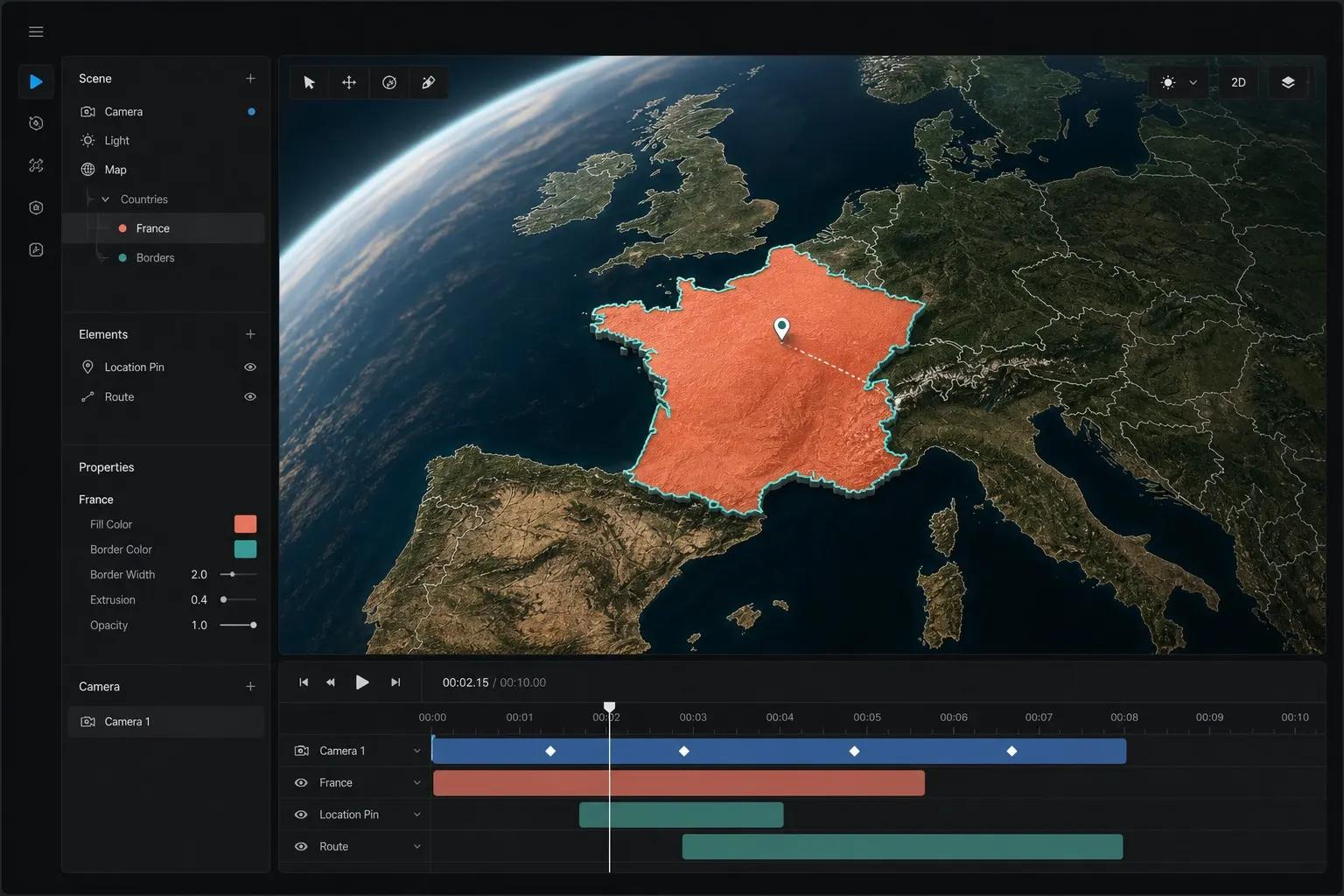
Type a place name. 3dmaps resolves boundaries, flies from the current camera, and holds on arrival so the story lands cleanly — no keyframes required.
Coming soonYou can register and sign in. Some features are still finishing up.
Product · Features
Every capability in the browser editor: Mapbox globe flyovers, flag fills, badges, draw, 3D models, text, camera hold, and Remotion exports — without opening After Effects.
01
Type a place name. 3dmaps resolves boundaries, flies from the current camera, and holds on arrival so the story lands cleanly — no keyframes required.
02
Mapbox satellite streets and globe projection deliver coastline depth flat SVG maps cannot match on social feeds.
03
Toggle flag fill to paint the selected country with its national pattern while keeping a glowing border.
04
Pin HQ markers, city badges, and emoji callouts that stay geo-anchored as the camera moves.
05
Sketch freehand strokes or add a city-to-city route. Attach a stock cutout or a 3D model so it travels the path. 3D Model Size, Model color, and Follow camera live on the route row.
06
Place styled labels with control over size, weight, and orientation — readable on hold frames.
07
Unlock to pan and zoom for a custom angle, then lock again for a repeatable Remotion export.
08
Render 16:9 or vertical MP4s on the 3DMaps.app supercomputer with progress polling and download.
09
Stock cards show a photo thumbnail or a cube — never a .glb as a picture. Click a model to park it at map center (no route required). Play shows the mesh on the map; export uses the thumbnail or cube.
10
Sign in to store project names, countries, flags, and badges in your dashboard for later edits.
Country/region search with Mapbox globe flyovers, optional flag fills, badges, freehand draw, stock cutouts and 3D models (click Stock to park, or attach to a path), text overlays, Hold Map camera control, social aspect-ratio exports via Remotion Cloud Run, and signed-in project saving. Play shows 3D meshes; exported MP4s use a thumbnail or cube for those models.
Yes. Choose a vertical social format before export in addition to widescreen 16:9 for YouTube.
Yes. The editor and renders use Mapbox satellite-streets styles with globe projection and GeoJSON boundaries for highlights.
No. All listed features run in the browser editor at / without a desktop NLE.
Use How it works for the four-step path, or the User Guide for the full handbook.